The Pilgrims’ Way Map was created within the project Pilgrims’ Way. Between theatre, ancient paths and new trekking. The project was completed in 2024 on the occasion of the celebrations of the 25 years of activity of the San Giuseppe Cultural Center, the secular body that has managed the spaces of the Church of San Giuseppe in Alba since 1999.
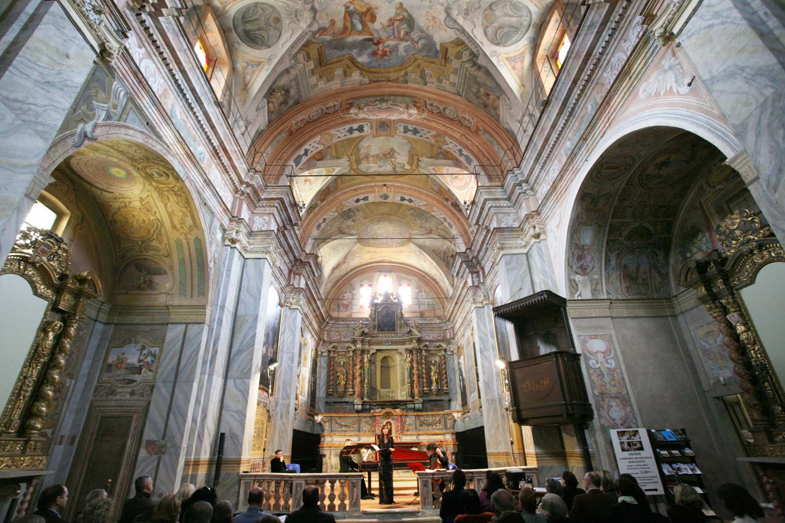
In fact, the splendid baroque church, home to the Company of Pilgrims of St. Joseph and built by them starting from 1643, was abandoned to neglect and decay at the end of the twentieth century, after the extinction of the Confraternity of San Giuseppe, but was recovered between 1996 and 2001 by Proteggere Insieme, civil protection specialized in safeguarding cultural heritage, and since then it has been a very active cultural center that offers hospitality and collaboration to other associations, including the Ambiente & Cultura association which carried out the project.
The activities were carried out thanks to the indispensable contribution of the Cassa di Risparmio di Cuneo Foundation, within the Cultural Heritage and Sustainable Tourism call, to the support of the Friends of the Via dei Pellegrini and to the proceeds of the guided tours of the project Underground Alba. The past lies under your feet!.
The Pilgrims’ Way has a main route of 80.5 km from the Church of San Giuseppe in Alba to the Regina Montis Regalis Sanctuary in Vicoforte Mondovì.
The town of Vicoforte is also the birthplace of San Teobaldo Roggeri, the pilgrim saint and co-patron saint of the city of Alba.
It is a linear E level trail (Hiking).
Four optional branches branch off from the main route: to Spiaggia dei Cristalli in Verduno; to the Novello Castle and the panoramic point on Monviso; to the Giant Bench #1 in Clavesana; to the Sanctuary of Mellea in Farigliano).
The Pilgrims’ Way crosses 13 municipalities: Alba, Verduno, Roddi, La Morra, Novello, Monforte, Dogliani, Farigliano, Clavesana, Bastia Mondovì, Niella Tanaro, Briaglia Mondovì and Vicoforte Mondovì.
The proposed trekking itinerary crosses the inhabited centers of the municipalities mentioned, so walkers every two or three hours of walking have the possibility of finding essential services and the possibility of refreshment and staying overnight.
THE AUDIO GUIDE AND THE GPX TRACK
Thanks to this Map of the Pilgrim’s Way and the GPX track it is possible to organize your trek in total autonomy. One possibility is to divide the trek into four days with three intermediate overnight stays. It is possible to access through the free Izi-Travel app a georeferenced and multimedia audio tour that accompanies the entire itinerary with 28 points of interest, divided into 5 categories (Art, History, Landscapes and Belvedere, Nature and the Tanaro river, the Life of Theobald). It is possible to download the GPX track and the Audiotour from the QRcodes on the front of the Pilgrims’ Way Map.